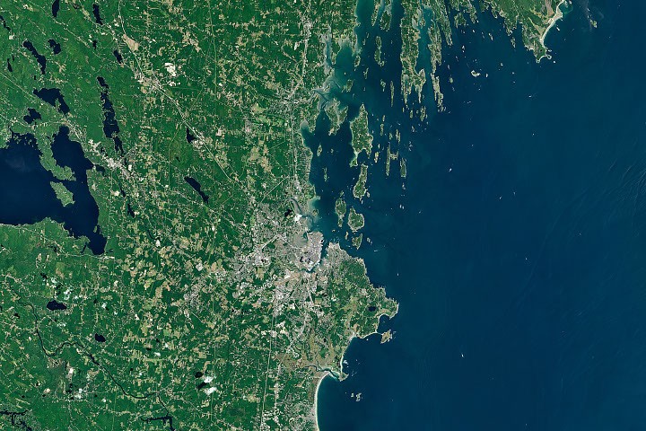
NASA is highlighting why Maine’s shoreline can shift so dramatically from broad sandy stretches to rugged, jagged coast. According to the agency’s science coverage, the contrast is especially noticeable on either side of Portland, where the shape and texture of the coast change in ways that are tied to geology and sediment movement.
The main explanation centers on two forces: the type of bedrock beneath the land and the way rivers deliver and spread sediment along the shore. Where conditions favor the buildup of sand and other loose material, beaches are more likely to form. In other areas, harder or differently structured rock remains exposed, helping create the sharper, rockier look associated with much of Maine’s northeastern coast.
The story also touches on the region’s deeper cultural history. The Wabanaki people have long held creation stories about the striking rocky shorelines of places such as the Bay of Fundy, Downeast Maine, and Acadia National Park. NASA’s piece places modern scientific interpretation alongside that long-standing sense of place, focusing on how natural processes shaped the coast over time.
Taken together, those factors help explain why the shoreline west of Portland can appear very different from the coast to the northeast. Rather than one uniform edge along the Atlantic, Maine’s coast reflects a mix of underlying rock and river-supplied sediment that produces a landscape of both sandy beaches and rugged headlands.